
Local History
Location And Significance
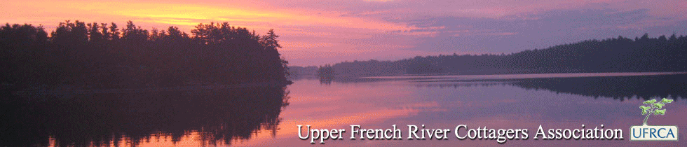
The French River flows for approximately 100 km from Lake Nipissing to Georgian Bay through a landscape that remains largely as it was when the first Europeans explored it over four hundred years ago and as it has been for thousands of years. From the Upper French River or southwest arm of Lake Nipissing (195.8 metres above sea level) to the northeast shore of Georgian Bay (177 metres above sea level) the river drops through heavily forested areas and bare open stretches of Canadian Shield. The river contains nationally significant archaeological and historical resources, natural features representative of the central Ontario section of the Canadian Shield, and exceptional recreational opportunities for small craft boating, fishing, canoeing and backcountry camping.
The French River and Lake Nipissing region is the historical homeland of First Nations peoples who now reside at three main locations: Nipissing First Nation east of Sturgeon Falls, Cantin Island First Nation near Highway 69, and Dokis First Nation (the UFRCA’s closest neighbours) located at the Chaudiere Dams and Okikendawt Island where the Upper French River begins its descent towards Georgian Bay.
In recognition of its natural, historic, and recreational value, the French River was identified by the Ontario government as a candidate provincial park in 1985 and received official park status in 1989; it is now known as French River Provincial Park. It is classed as a Waterway Park.
The Canadian Heritage Rivers Board officially designated the French River as a Canadian Heritage River in 1986. The French River represents an important addition to the Canadian Heritage River System. It contributes one of the best examples of a glaciated Canadian Shield river environment. It demonstrates the significance of waterways as Indian travel routes before European contact and adds a very important section of the historic Voyageur Route, the major water transportation corridor in Canada’s development between 1615 and 1821. The French River provides an outstanding recreation area combining tourist development and extensive natural areas.
The Watershed
In addition to the French River itself, the adjacent area contains more than 200 km of other navigable watercourses and channels that vary from narrow, enclosed steep-walled gorges, falls and rapids, to broad expanses of open water. Lake Nipissing itself drains several important river systems. Notable are the South River, that drains an extensive part of Parry Sound District and the north-west corner of Algonquin Park, and the Sturgeon River that drains the entire Temagami Lake region. Many other rivers such as the Wolsely, Wanapitei, and Pickerel flow into the French River at further points downstream. The French River thus plays an important role in the drainage of the Georgian Bay watershed.
Its notable natural features include:
-
Geographical features, such as Recollet Falls, which illustrates the building of the Canadian Shield 900 to 1600 million years ago
-
An extensive bedrock delta on Georgian Bay which displays spectacular evidence of glacial erosion
-
More than 450 plant species, eight of which are rare, representing both the Boreal and the Great Lakes – St. Lawrence forest regions
-
Extensive wetlands at the river’s mouth on Georgian Bay, which provide habitat for the most abundant population of Virginia Chain Fern in Canada
-
Habitat for the largest population of the eastern Massasauga rattlesnake (not on the Upper French River) and for a significant population of yellow pickerel. Highway 69 is a significant and formidable barrier to the migration of the slow-moving Massasauga rattlesnakes, and most are located west of the highway. There have been a few sightings east of Highway 69.
-
Many areas of exceptional natural beauty, characterized by narrow bedrock-lined channels, islands, rapids, and falls.
-
A fascinating example of a geologically young river compared to the Precambrian rock it cuts through. When the last ice sheets disappeared about 10 000 years ago, the land started to slowly rise, rebounding from the enormous mass of glacial ice. Ancient Lake Nipissing at that time flowed eastward through what is known as the Fossmill Outlet and drained through what is now the Ottawa River. As the land continued to rise, it reached a point, only about 3000 years ago, when a sill was formed where North Bay is now located, creating a height of land. The river then reversed itself and flowed westward, draining Lake Nipissing toward Georgian Bay. The land continues to rise at the rate of about 50 cm per century (about 5 mm per year) at the Lake Nipissing end and about 35 cm per century at Georgian Bay. The French River, then, is slowly becoming more tilted.
Historical Role
The French River has provided the setting for several episodes in Canada’s development as a nation:
-
Unique rock paintings (pictographs), Indian place names, and archaeological sites along the corridor indicate that the French River once served as a major water transportation route used by Shield Archaic and Algonkian native peoples prior to European exploration
-
Posted June 8, 2016. A prime example of local pictographs is located on Kennedy Island. It was researched and documented in the 1980s by Nick Adams, Field Archeologist with the Ontario Ministry of Culture and Recreation. To view the drawing and explanation of the pictograph, select the Download link below:
-
Download: Kennedy Island Pictographs.pdf (3 MB, 1,856 downloads so far)
-
-
The French River was so named by Ojibwa Indians because it brought to their land French missionaries and explorers: Etienne Brule, in 1610, and Samuel de Champlain, in 1615, produced the first maps and descriptions of the area and its people for New France. Between 1629 and 1649 the missionary Recollet and Jesuit Fathers came to live among the Huron Indians near present-day Midland, followed by explorers Jean Nicolet, Pierre Radisson, des Groseillers and La Verendrye
-
These explorers were quickly followed by European traders who transported furs from western and central Canada to the eastern markets. The French River’s development as a fur trade route during the 18th and early 19thcenturies was encouraged by use of the route by the explorers Alexander Mackenzie, Simon Fraser, and David Thompson. With them also came the French coureurs-de-bois of the North West Company and the Hudson’s Bay Company
-
With the demise of the fur trade, timber became the French River's main economic generator, and its exploration brought with it the first European settlers. In 1875, the settlement of French River Village grew as a thriving sawmilling community near the river’s mouth on Georgian Bay. Another town site called Coponaning was planned and surveyed but never built.
-
The Grand Trunk Railway, which reached North Bay in 1886, opened the area for sports and recreation development in the latter part of the 19th century. Tourists travelled by steam and sailboat to a variety of fishing lodges and resorts, and the first summer homes were built on the French.
Today the French River corridor is used almost exclusively for recreation.
Many sources relating to the Nipissing Indians and the development of North Bay, Lake Nipissing and the French River are widely available.
Highly recommended is FRENCH RIVER – CANOEING THE RIVER OF THE STICK-WAVERS,
by Toni Harting, Boston Mills Press, 1996.
Another excellent resource is the Map of French River Provincial Park, produced by Friends of the French and available at the Visitors Centre, local businesses that sell Park overnight camping permits, and specialty outdoors and camping stores.
W.K.P. Kennedy compiled a history of North Bay and region in 1961 entitled NORTH BAY - Past – Present – Prospective, Best Printing, 1961. Although out of print, it is available through Nipissing University as a course package for HIST 4375 Community History: Approaches, Sources and Methods. It is also available and fully indexed on-line at http://www.ourroots.ca/e/toc.aspx?id=6140
Pictograph on Kennedy Island
Posted June 8, 2016
In the 1980s, a field archeologist with the Ontario government researched and published a paper on the pictograph located on Kennedy Island. To view the document go to History - Local Area History http://ufrca.com/index.php?page=history%2Flocal-area-history and scroll down to Historical Importance. Thanks to Holly Waters for discovering this document.